The Algarve, southern Portugal
The Algarve is the southernmost region of mainland Portugal, with 467 343 inhabitants across 4 997 km² and a coastline on the Atlantic Ocean to the south and west. Its beaches, golf courses, mild climate and the heritage of its towns and villages make it the main tourist region in Portugal.
The region is divided into two parts. The Barlavento, in the west, includes Albufeira, Portimão, Lagos, Sagres and Aljezur, with a coast of cliffs and rock formations above pale sandy beaches.
The Sotavento, in the east, includes Loulé, Faro, the regional capital, Olhão, Tavira and Vila Real de Santo António, with the Ria Formosa Natural Park along its coast.
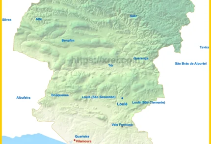
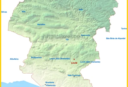
The Golden Triangle, formed by the resorts of Quinta do Lago, Vale do Lobo and Vilamoura, lies in the municipality of Loulé, where the two parts meet.
Inland, the landscape changes in three bands: the coastal strip; the barrocal, a belt of limestone hills with almond, carob, olive and fig trees; and the serra, the Monchique and Caldeirão ranges along the border with the Alentejo.
Trails in the Algarve
- Via Algarviana: long-distance walking trail of about 300 kilometres, divided into sections, across the interior between Alcoutim and Cabo de São Vicente.
- Ecovia Litoral: coastal route for walking and cycling on cycle paths and dirt tracks, from Vila Real de Santo António to Sagres.
What to do in the Algarve
- Beaches: pale sand, clear water, dunes and reddish cliffs along the south coast, and wilder beaches on the west coast.
- Surfing: the west coast around Sagres is a reference for surfing, with waves for all levels.
- Golf: the main sport of the region, with courses from Lagos to Castro Marim.
- Hiking and birdwatching: in the Ria Formosa, the Costa Vicentina and the hills of the barrocal and the serra.
- Culture and history: festivals, museums and built heritage in towns and villages across the region.
- Gastronomy: fresh fish, inland recipes and sweets made from almonds, figs and carob.
- Boat trips: trips by boat or guided kayak along the cliffs of the central coast to the Benagil sea cave, from Albufeira, Portimão, Lagos and other marinas.
Municipalities of the Algarve
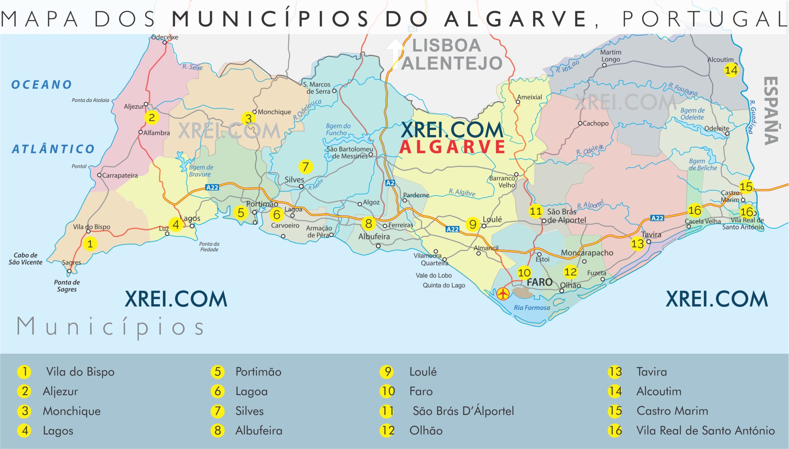
The Algarve has 16 municipalities, eight in the Sotavento and eight in the Barlavento.
Sotavento
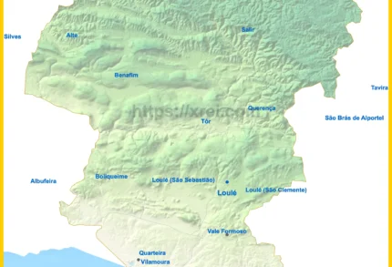
- Loulé (72 332 inhabitants · 764 km²)
- Faro (67 622 inhabitants · 203 km²)
- Olhão (44 614 inhabitants · 131 km²)
- Tavira (27 523 inhabitants · 607 km²)
- Vila Real de Santo António (18 824 inhabitants · 61 km²)
- Castro Marim (6 439 inhabitants · 301 km²)
- São Brás de Alportel (11 248 inhabitants · 153 km²)
- Alcoutim (2 523 inhabitants · 575 km²)
Barlavento
- Albufeira (44 164 inhabitants · 141 km²)
- Portimão (59 845 inhabitants · 182 km²)
- Lagoa (23 725 inhabitants · 88 km²)
- Silves (37 766 inhabitants · 680 km²)
- Monchique (5 462 inhabitants · 395 km²)
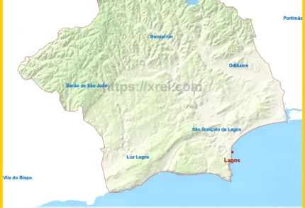
- Lagos (33 494 inhabitants · 213 km²)
- Vila do Bispo (5 717 inhabitants · 179 km²)
- Aljezur (6 045 inhabitants · 324 km²)
Golden Triangle
Loulé holds three of the most valuable real estate areas in Portugal. Quinta do Lago, Vale do Lobo and Vilamoura are resorts, not parishes or municipalities. They sit within the parishes of Almancil and Quarteira, in the municipality of Loulé.
Together they form the Golden Triangle, the area of the Algarve known for golf courses, marinas and luxury property, with ocean access and warm weather through the year.
- Golf: 14 courses, several of which host international tournaments.
- Sailing: the Marina de Vilamoura, with 825 berths for vessels up to 60 metres.
- Beaches: sand backed by dunes and cliffs.
- Property: Quinta do Lago and Vale do Lobo serve the high-end market, with individual sales above €10 million, while Vilamoura has a broader market and a more family-oriented lifestyle.
- Community: residents from many countries, which makes the area multilingual.
Theme and water parks
The Algarve has four large theme and water parks:
- Zoomarine Algarve, in Guia, Albufeira, combines marine animals, exotic birds and reptiles, dolphin shows, pools and slides.
- Aquashow Park, in Quarteira, has a wave pool, a roller coaster, slides and pools for all ages.
- Aqualand Algarve, in Alcantarilha, Silves, is a family water park with slides and pools.
- Slide & Splash, in Estômbar, Lagoa, between Lagoa and Portimão, has water attractions, shows and spa services.
History of the Algarve
The Algarve has been inhabited since prehistory, as the megalithic monuments of Alcalar, near Portimão, show. Phoenicians, Carthaginians, Romans, Visigoths and Arabs followed.
Muslim rule lasted more than five centuries, from the early 8th century to 1249, and reached its height in Silves, the capital of al-Gharb al-Andalus. The name means "the west" in Arabic and gave the region its name. This period left its mark on the Algarve's chimneys, its irrigation techniques and many Portuguese words beginning with "al".
King Afonso III completed the conquest of the Algarve in 1249. During the Age of Discovery, Lagos and Sagres grew in importance through the presence of Prince Henry the Navigator. The region then declined between the 17th and 19th centuries.
Key dates in the history of the Algarve:
- 1249: King Afonso III conquers Faro and completes the conquest of the Algarve;
- 1755: the Lisbon earthquake and tsunami destroy much of the Algarve coast;
- 1773: the Companhia Geral das Reais Pescarias do Reino do Algarve is founded;
- 1774: the Marquis of Pombal founds Vila Real de Santo António;
- 1808: the people of Olhão rise against the French invasion;
- 1889: the railway reaches Faro;
- 1962: Vale do Lobo is founded, one of the first tourist resorts in Portugal, and the government decides to build Faro Airport;
- 1970s: Quinta do Lago, founded in 1971, and Vilamoura follow, and tourism becomes the base of the regional economy;
- 1990s: the Algarve is promoted as a "Sun and Golf" destination.
The Algarve is today the leading tourist region in Portugal, with golf, beaches, resorts, marinas, birdwatching, wine, gastronomy, equestrian sports and a real estate market that draws international buyers.
Geography of the Algarve
The Algarve borders the Alentejo to the north, the Atlantic Ocean to the west and south, and Spain to the east, across the River Guadiana. The region is about 135 km long and up to 40 km wide.
It divides into three zones:
- Barlavento (western Algarve): the municipalities of Albufeira, Aljezur, Lagoa, Lagos, Monchique, Portimão, Silves and Vila do Bispo, with cliff-backed beaches such as Praia do Carvoeiro, the Parque Natural do Sudoeste Alentejano e Costa Vicentina, the Benagil sea cave and fishing villages;
- Sotavento (eastern Algarve): the municipalities of Alcoutim, Castro Marim, Faro, Loulé, Olhão, São Brás de Alportel, Tavira and Vila Real de Santo António, with the Ria Formosa Natural Park along the coast from Ancão to Manta Rota;
- Central Algarve: the meeting point of the Barlavento and Sotavento, where the Golden Triangle sits. A service economy has grown around it, with golf courses, five-star hotels, Michelin-starred restaurants, architecture, engineering, interior design and landscaping firms, real estate agencies and supermarkets serving international residents.
Climate of the Algarve
- Mountain shelter: the Monchique, Caldeirão and Espinhaço de Cão ranges block colder northern air and create local microclimates along the south coast.
- Levante: the warm easterly wind from the Strait of Gibraltar reaches the eastern Algarve, where the sea is usually warmer than in the west.
- West coast: in summer, the north wind known as the nortada causes coastal upwelling, which brings colder water to the surface. In one summer week of 2026, the sea measured 18.5 to 19.5 °C between Sagres and Portimão and about 22 °C between Faro and Vila Real de Santo António.
Algarve coastline
The Algarve coastline, about 200 km long, is the most densely populated part of the region. It divides into three areas:
- the Costa Vicentina, on the west coast, with high cliffs and fossil dune fields;
- the Sagres peninsula, with Cabo de São Vicente, the Fortaleza de Sagres and high cliff beaches with surf;
- the southern coast, with limestone cliffs in the west and long sandy beaches and barrier islands in the east.
Barrocal Algarvio
The barrocal lies between the coast and the serra, from Cabo de São Vicente to Castro Marim. Almond, carob, olive and fig trees grow here and supply many of the Algarve's typical products. Its sites of geological, landscape and cultural interest include the Cascata do Pego do Inferno, Cerro da Cabeça, Cerro de São Miguel, Rocha da Pena, Fonte Benémola, Nave do Barão, Castelo de Paderne and Castelo de Salir.
Serra Algarvia
The serra covers about half of the Algarve, along the border with the Alentejo. Its ranges are:
- the Serra de Monchique, in the west, whose highest point, Fóia, reaches 902 metres;
- the Serra do Caldeirão, in the centre and east, whose highest point, Pelados, reaches 589 metres;
- the Serra de Monte Figo, across Faro, Olhão, Loulé and São Brás de Alportel, whose highest point, Cerro de São Miguel, reaches 411 metres;
- the Serra de Espinhaço de Cão, in the west, whose highest point, the Poldra geodesic marker, reaches 248 metres.
Main shopping centres in the Algarve
- AlgarveShopping, in the parish of Guia, Albufeira;
- MAR Shopping, the Designer Outlet Algarve and IKEA, near junction 13 of the A22 motorway, between Loulé and Faro;
- Forum Algarve, at the entrance to Faro;
- Aqua Portimão and Arade Shopping Centre, in Portimão;
- Tavira Gran Plaza, in Tavira;
- Lagos Retail Park, in Lagos;
- Algarve Outlet, in Olhão;
- Quinta Shopping, at the entrance to Quinta do Lago.
Faro International Airport
Faro International Airport lies about four kilometres west of Faro and is the main gateway to the region. Domestic flights connect Faro with Lisbon, Porto, Ponta Delgada in the Azores and Funchal in Madeira. International flights connect Faro with cities across Europe, with the United Kingdom, Germany, the Netherlands and Ireland as the largest markets, and seasonal flights to Canada.
Marinas and harbours of the Algarve
Sailors crossing the Atlantic from the Americas and the Caribbean, and those arriving from northern Europe and the Mediterranean, use the Algarve marinas as a stopover.
- Marina de Vilamoura: the first marina in Portugal, opened in 1974, with 825 berths for vessels up to 60 metres long and 4 metres draught. It lies about 160 nautical miles from Lisbon, 140 from Gibraltar and 190 from Puerto Banús. Its awards include the Blue Flag and Best Marina in Portugal at the Publituris Portugal Trade Awards. The CIMAV sailing club, founded in 1975, trains young sailors and organises regattas, including the Torneio Internacional de Vela do Carnaval.
- Marina de Albufeira: opened in 2004 west of the city centre, with 475 berths for vessels up to 32 metres long and 4.5 metres draught. Its awards include Five Gold Anchors from The Yacht Harbour Association and the Blue Flag.
- Marina de Lagos: opened in 1994 on the eastern bank of the Ribeira de Bensafrim, near the historic centre, with 462 berths for vessels up to 30 metres long and 3 metres draught. Its awards include Five Gold Anchors and the Blue Flag.
- Marina de Portimão: 620 berths for vessels up to 50 metres long and 4.2 metres draught. Its awards include the Blue Flag.
- Porto de Recreio de Olhão: inside the Ria Formosa, with capacity for 320 vessels up to 15 metres long and 2.5 metres draught.
- Porto de Recreio de Tavira: about 70 berths for small vessels.
- Porto de Recreio do Guadiana: in Vila Real de Santo António, with capacity for 360 vessels up to 20 metres long and 3 metres draught, and the sailing school of the Associação Naval do Guadiana.
- Doca de Recreio de Faro and Porto de Recreio de Alvor: smaller harbours for leisure craft.
Hospitals in the Algarve
Public hospitals are run by the Unidade Local de Saúde do Algarve:
- Hospital de Faro;
- Hospital de Portimão;
- Hospital de Lagos.
Private hospitals:
- Hospital da Luz Loulé;
- Hospital Lusíadas Albufeira and Hospital Lusíadas Vilamoura;
- CUF Alvor Hospital, CUF Faro Hospital and Hospital de São Camilo, in Portimão;
- Hospital Terras do Infante, in Lagos.