Lagos

Lagos

Lagos is a coastal city in the western Algarve, with 33 494 inhabitants across 213 km², known for its role in the Portuguese Age of Discovery, its beaches and its historical and cultural heritage.

The largely pedestrian old town sits inside the city walls. The Avenida dos Descobrimentos, beside the Ribeira de Bensafrim, looks over the boats moving between the sea, the marina and the fishing harbour.

Beaches in Lagos

  • Meia Praia: long sandy beach east of the city, from the harbour breakwater towards the Ria de Alvor.
  • Praia de São Roque: beach next to Meia Praia.
  • Praia da Batata: town beach at the start of the cliff trail.
  • Praia dos Estudantes: beach crossed by a stone footbridge known as the Ponte Romana.
  • Praia do Pinhão: small beach below the cliffs.
  • Praia de Dona Ana: beach framed by rock formations.
  • Praia do Camilo: small beach reached by a long wooden staircase.
  • Praia da Boneca, Praia dos Pinheiros and Praia da Balança: small beaches at the foot of the cliffs towards Ponta da Piedade.
  • Praia do Canavial and Praia do Barranco do Martinho: small beaches beyond Ponta da Piedade.
  • Praia de Porto de Mós: beach with high cliffs and calm water.

Monuments in Lagos

  • City walls and Porta de São Gonçalo: walls around the old town, with a gate between two tall towers.
  • Igreja de Santo António: church rebuilt in 1769 after the 1755 earthquake, with one of the richest interiors of Baroque gilded woodwork in the Algarve.
  • Igreja de Santa Maria: parish church with a collection of Rococo religious images.
  • Forte da Meia Praia: ruins of a square 17th-century coastal fort in the dunes of Meia Praia.
  • Farol da Ponta da Piedade: 20th-century lighthouse above the sea caves.

Museums and culture in Lagos

  • Museu Municipal Dr. José Formosinho: municipal museum next to the Igreja de Santo António.
  • Núcleo Museológico Rota da Escravatura: museum in the building known as the Mercado de Escravos, on the sale of enslaved Africans in Lagos from the 15th century.
  • Centro Ciência Viva de Lagos: science exhibitions and activities for all ages.

Markets in Lagos

  • Mercado Municipal: fresh fish and produce, near the fishing harbour.

Nature in Lagos

  • Ponta da Piedade: headland with sea caves and rock arches, visited by boat.
  • Cliff trail: path from the Avenida dos Descobrimentos past the Miradouro da Praia da Batata to Ponta da Piedade and Porto de Mós.
  • Barragem da Bravura: reservoir in the hills of Bensafrim.

Golf in Lagos

Marinas in Lagos

  • Marina de Lagos: 462 berths near the historic centre.
  • Clube de Vela de Lagos: sailing club on the cliff trail.
  • Boat trips: trips of about two hours from the Marina de Lagos to the Benagil sea cave, and shorter trips to the caves of Ponta da Piedade.

Parishes of Lagos

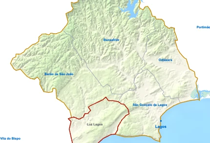
  • Luz (4 355 inhabitants · 22 km²): former fishing village west of the city.
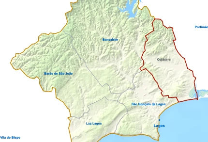
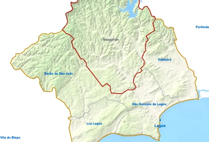
  • Odiáxere (3 046 inhabitants · 32 km²), Bensafrim (1 530 inhabitants · 78 km²) and Barão de São João (895 inhabitants · 52 km²): inland parishes.

Healthcare in Lagos

Places to visit in the Algarve

Barlavento, the windward Algarve

Golden Triangle

Sotavento, the leeward Algarve

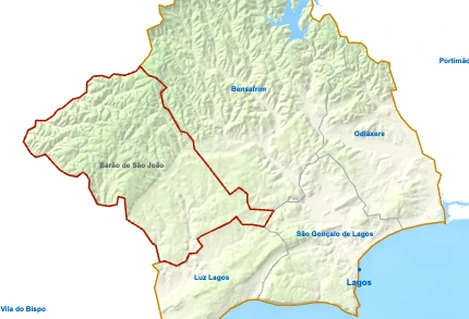
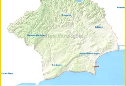
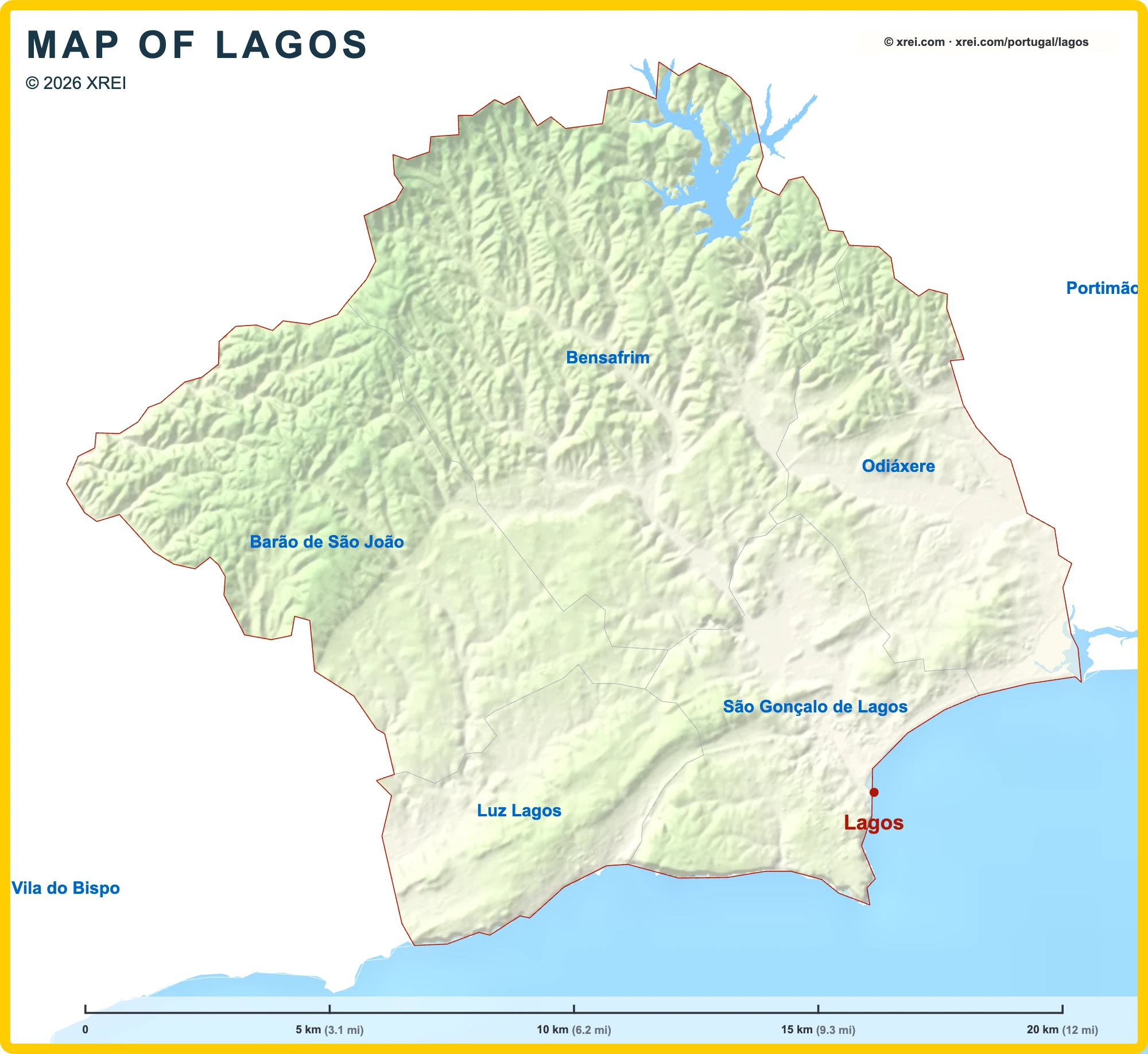
Parishes of Lagos map

Lagos is a Municipality of Algarve in Portugal in the continent of Europe.

Map drawing by Jhose.com. Boundaries from CAOP, DGT Portugal. Reuse of this drawing requires attribution to xrei.com.SpainAlbufeiraAlcoutimAljezurCastro MarimFaroLagoaLouléMonchiqueOlhãoPortimãoSão Brás de AlportelSilvesTaviraVila do BispoVila Real de Santo AntónioLuz LagosOdiáxereSão Gonçalo de LagosBarão de São JoãoBensafrimAlbufeiraAlcoutimAljezurCastro MarimFaroLagoaLouléMonchiqueOlhãoPortimãoSão Brás de AlportelSilvesTaviraVila do BispoVila Real de Santo AntónioLuz LagosOdiáxereSão Gonçalo de LagosBarão de São JoãoBensafrimPortimãoVila do BispoLuz LagosOdiáxereSão Gonçalo de LagosBarão de São JoãoBensafrimLagosLagosxrei.comMAP OF LAGOS© 2026 xrei.com
05 km (3.1 mi)10 km (6.2 mi)15 km (9.3 mi)20 km (12 mi)
Height
0 m (0 ft), 80 m (262 ft), 200 m (656 ft), Max altitude 255 m (837 ft)
Sea depth
0 m (0 ft), 150 m (492 ft), 600 m (1970 ft), 1800 m (5910 ft), 3200 m (10500 ft), deeper than 5200 m (17060 ft)
Height from south to north in Lagos
0 m80 m200 m400 mxrei.com12255 m0 mSouth18.1 kmNorth
1Sea0 m2Albufeira de Odeáxere81 m

Basic Information

Lagos population (data from last censos): Municipality has 33 494 Inhabitants

Lagos area: Municipality has 213 km² / 82 sq mi

Where is Lagos located in Portugal?

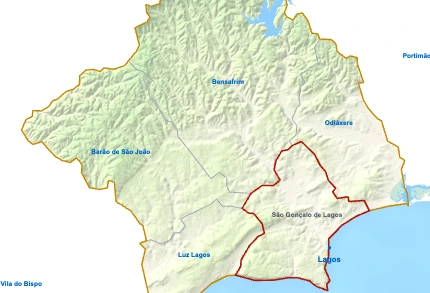
Parishes of Lagos

São Gonçalo de Lagos

São Gonçalo de Lagos

  • Parish population⁨23 648 inhabitants⁩
  • Parish area⁨29 km²
    11 sq mi
    ⁩
Luz Lagos

Luz Lagos

  • Parish population⁨4 355 inhabitants⁩
  • Parish area⁨22 km²
    8 sq mi
    ⁩
Odiáxere

Odiáxere

  • Parish population⁨3 046 inhabitants⁩
  • Parish area⁨32 km²
    12 sq mi
    ⁩
Bensafrim

Bensafrim

  • Parish population⁨1 530 inhabitants⁩
  • Parish area⁨78 km²
    30 sq mi
    ⁩
Barão de São João

Barão de São João

  • Parish population⁨895 inhabitants⁩
  • Parish area⁨52 km²
    20 sq mi
    ⁩

Municipalities of Algarve

Loulé

Loulé

  • Municipality population⁨72 332 inhabitants⁩
  • Municipality area⁨764 km²
    295 sq mi
    ⁩
Faro

Faro

  • Municipality population⁨67 622 inhabitants⁩
  • Municipality area⁨203 km²
    78 sq mi
    ⁩
Portimão

Portimão

  • Municipality population⁨59 845 inhabitants⁩
  • Municipality area⁨182 km²
    70 sq mi
    ⁩
Olhão

Olhão

  • Municipality population⁨44 614 inhabitants⁩
  • Municipality area⁨131 km²
    51 sq mi
    ⁩
Albufeira

Albufeira

  • Municipality population⁨44 164 inhabitants⁩
  • Municipality area⁨141 km²
    54 sq mi
    ⁩
Silves

Silves

  • Municipality population⁨37 766 inhabitants⁩
  • Municipality area⁨680 km²
    263 sq mi
    ⁩
Lagos

LagosYou’re reading this article

  • Municipality population⁨33 494 inhabitants⁩
  • Municipality area⁨213 km²
    82 sq mi
    ⁩
Tavira

Tavira

  • Municipality population⁨27 523 inhabitants⁩
  • Municipality area⁨607 km²
    234 sq mi
    ⁩
Lagoa

Lagoa

  • Municipality population⁨23 725 inhabitants⁩
  • Municipality area⁨88 km²
    34 sq mi
    ⁩
Vila Real de Santo António

Vila Real de Santo António

  • Municipality population⁨18 824 inhabitants⁩
  • Municipality area⁨61 km²
    24 sq mi
    ⁩
São Brás de Alportel

São Brás de Alportel

  • Municipality population⁨11 248 inhabitants⁩
  • Municipality area⁨153 km²
    59 sq mi
    ⁩
Castro Marim

Castro Marim

  • Municipality population⁨6 439 inhabitants⁩
  • Municipality area⁨301 km²
    116 sq mi
    ⁩
Aljezur

Aljezur

  • Municipality population⁨6 045 inhabitants⁩
  • Municipality area⁨324 km²
    125 sq mi
    ⁩
Vila do Bispo

Vila do Bispo

  • Municipality population⁨5 717 inhabitants⁩
  • Municipality area⁨179 km²
    69 sq mi
    ⁩
Monchique

Monchique

  • Municipality population⁨5 462 inhabitants⁩
  • Municipality area⁨395 km²
    153 sq mi
    ⁩
Alcoutim

Alcoutim

  • Municipality population⁨2 523 inhabitants⁩
  • Municipality area⁨575 km²
    222 sq mi
    ⁩

We're Close to You

XREI operates from offices across Portugal — from Porto to the Algarve.

North

Porto — Edifício ICON

Rua Direita de Francos, 165 Piso 1 · 4100-211 Porto

Greater Lisbon

Lisboa — Rua Castilho

Rua Castilho, 39 · 1250-068 Lisboa

Greater Lisbon

Estoril

Avenida Aida, 353A · 2765-187 Estoril

Alentejo Coast

Comporta

Av. 18 Dezembro, 37 · 7570-779 Carvalhal

Algarve

Vilamoura — Marina Plaza

Av. da Marina, 3 · Marina Plaza Loja 14/15 · 8125-401 Quarteira