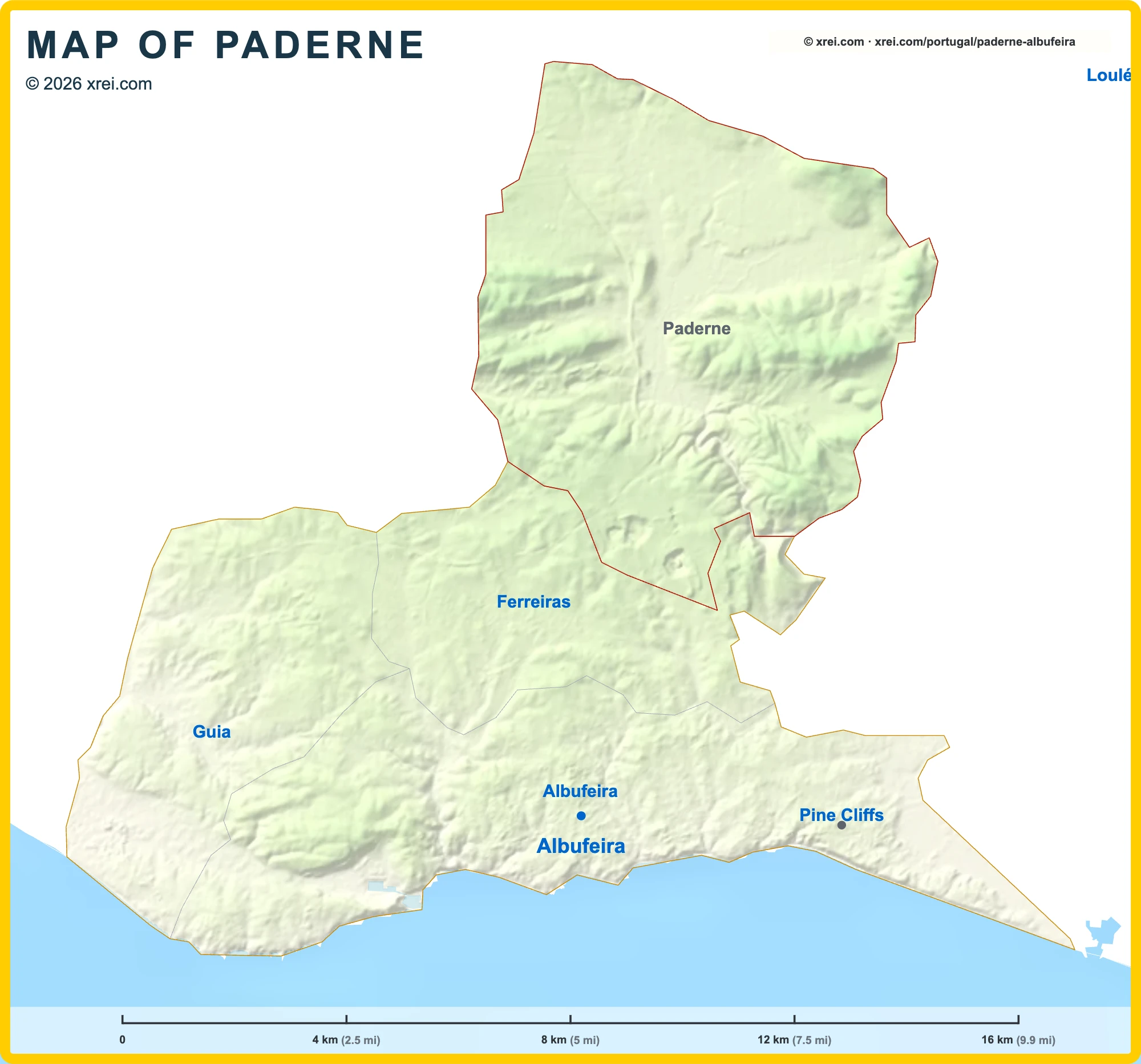
Paderne is a rural parish of Albufeira, with 3 498 inhabitants across 53 km², in the barrocal hills north of the coast.
Paderne Street Map

123456TTTIgreja Matriz de PaderneErmida de Nossa Senhora do Pé da CruzErmida da Nossa Senhora da Assunção, PaderneFonte em PaderneCastle of PaderneBridge of PaderneFaro Airport (FAO) 27 kmAlte 10 kmAlbufeira 9 kmAlgoz 9 kmVilamoura 13 kmQuarteira RiverRibeira de AlteBoliqueimeFerreirasTunesSerra de Monchique 16 kmRia Formosa Nature Park 19 kmAlbufeira - FerreirasBoliqueimeTunesSparIntermarché SuperPingo DoceAldiLidlAldiMercado Munícipal das Ferreiras
Getting there
- TAlbufeira - Ferreiras Train station
- TBoliqueime Train station
- TTunes Train station
Useful places
- 1Igreja Matriz de Paderne church
- 2Ermida de Nossa Senhora do Pé da Cruz chapel
- 3Ermida da Nossa Senhora da Assunção, Paderne church
- 4Fonte em Paderne fountain
- 5Castle of Paderne fortification
- 6Bridge of Paderne bridge
- Eden Montessori International School Private School
- Horse Riding Albufeira (Salgados) Equestrian Centre
Water
- ≈Quarteira River River
- ≈Ribeira de Alte River
Landmarks
- Serra de Monchique protected area, 16 km NW
- Ria Formosa Nature Park protected area, 19 km SE
Supermarkets
- Spar Rua do Olival
- Intermarché Super Avenida 12 de Julho
- Pingo Doce Avenida 12 de Julho
- Aldi Avenida 12 de Julho
- Lidl Avenida Professor Doutor Aníbal Cavaco Silva
- Aldi Avenida Professor Doutor Aníbal António Cavaco Silva
Local life
- Mercado Munícipal das Ferreiras Market
Airports
- ✈Faro Airport (FAO) 27 km SE
Map by xrei.com/portugal/paderne-albufeira/ © OpenStreetMap contributors
Monuments in Paderne
- Castelo de Paderne: ruins of a small fortification of Islamic origin, first recorded in the 12th century, on a hill above the Ribeira de Quarteira. It was part of the defensive network of the region and is a stop on walking trails.
- Ponte Medieval: bridge over the Ribeira de Quarteira near the castle, rebuilt in the 18th century.
- Igreja Matriz de Paderne: 16th-century church dedicated to Nossa Senhora da Esperança, with Manueline and Renaissance features and Baroque altarpieces.
Places to visit in the Algarve