Alvor

Alvor

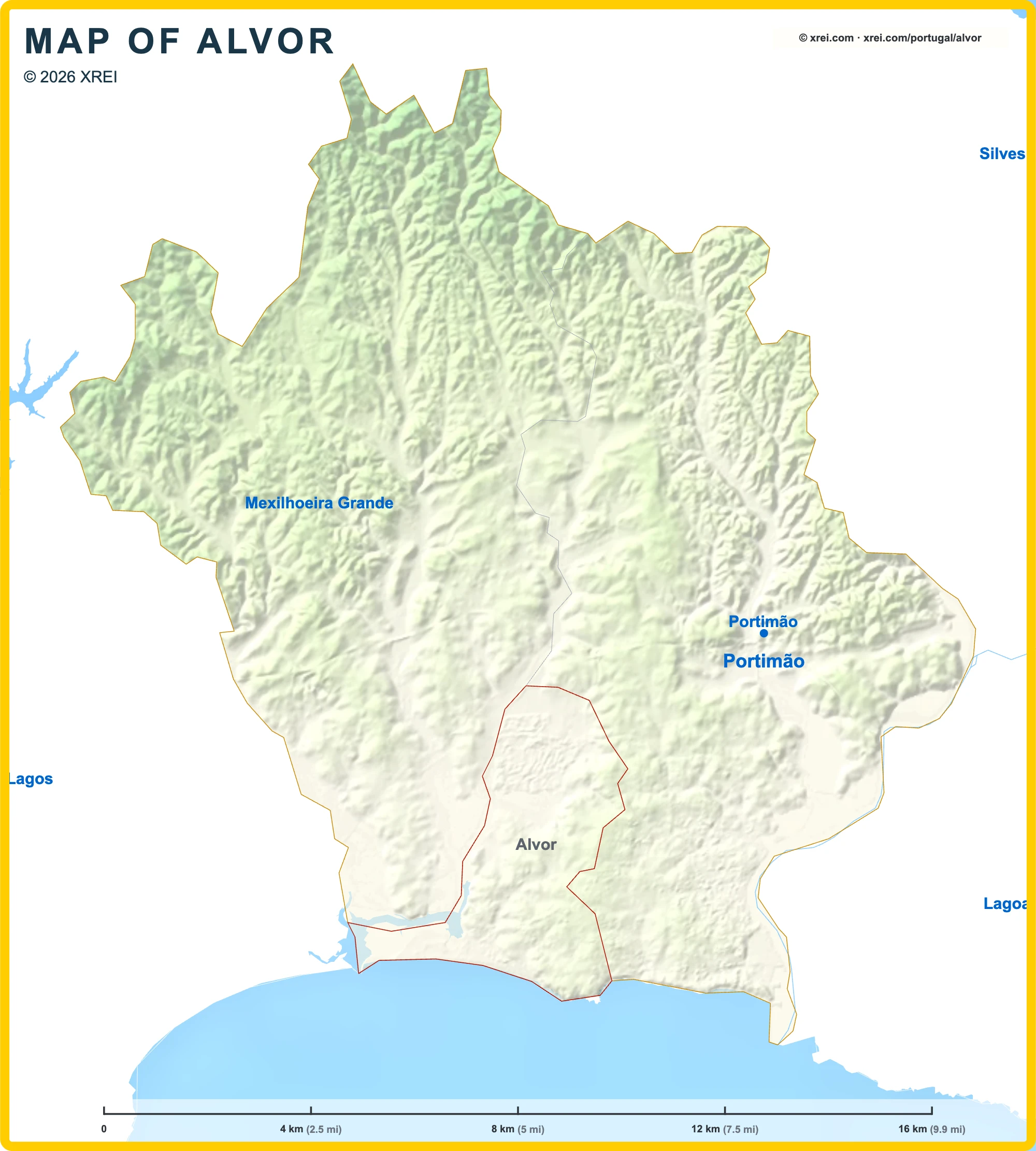
Alvor is a fishing village and parish of Portimão, with 6 314 inhabitants across 15 km², on the estuary of the Ria de Alvor, between Portimão and Lagos.

Whitewashed houses climb from the fishing harbour to the parish church at the top of the old village. Below the village, a long sandy beach and a boardwalk over the dunes separate the ria from the ocean.

History of Alvor

King João II died in Alvor on 25 October 1495, in the house of the local governor, Álvaro de Ataíde. His successor, King Manuel I, raised Alvor to the status of town and ordered the construction of its parish church in his memory.

In January 1975, the Alvor Agreement was signed here, through which Portugal recognised the independence of Angola.

Beaches in Alvor

  • Praia de Alvor Poente: western end of the long Alvor beach, next to the mouth of the ria.
  • Praia de Alvor Nascente: eastern end of the beach, towards the cliffs.
  • Praia dos Três Irmãos: beach with rock stacks, where the cliffs of Portimão begin.
  • Praia da Prainha: small coves among the rocks, east of Três Irmãos.
  • Praia da Torralta: beach below the cliffs on the way to Portimão.

Monuments in Alvor

  • Igreja Matriz de Alvor (Igreja do Divino Salvador): church begun in 1496 and completed in the 1520s, on the highest point of the old village. Its Manueline main and side portals have been classified as a property of public interest since 1948.
  • Morabito: small domed Islamic shrine attached to the church and used as one of its chapels, classified in 1978.
  • Castelo de Alvor: remains of the walls of the medieval castle, damaged in the 1755 earthquake, in the centre of the village near the market. The site now holds a children's playground.
  • Monumento ao Pescador: sculpture by João Cutileiro on the waterfront, next to the harbour.

Nature in Alvor

  • Ria de Alvor: estuary and wetland of national importance, with salt marshes, dunes and resident and migratory birds.
  • Passadiços de Alvor: raised boardwalk over the dunes and salt marshes, with views over the estuary and its wildlife.

Golf in Alvor

Marinas in Alvor

Healthcare in Alvor

Places near Alvor

  • Portimão (59 845 inhabitants · 182 km²): city to the east, with Praia da Rocha.
  • Mexilhoeira Grande (4 313 inhabitants · 91 km²): parish to the north, with the Alcalar megalithic monuments.
  • Lagos (33 494 inhabitants · 213 km²): city to the west, across the Ria de Alvor.

Places to visit in the Algarve


Parishes of Portimão map

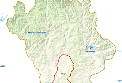
Alvor is a Parish of Portimão in Portugal in the continent of Europe.

Map drawing by Jhose.com. Reuse of this drawing requires attribution to xrei.com. Sources used on xrei maps (each map names its own under it): Informação geográfica cedida pela Direção-Geral do Território (CAOP, CC BY 4.0) | © OpenStreetMap contributors (ODbL) | GEBCO 2026 Grid | Heights: NASADEM, NASASpainAlbufeiraAlcoutimAljezurCastro MarimFaroLagoaLagosLouléMonchiqueOlhãoSão Brás de AlportelSilvesTaviraVila do BispoVila Real de Santo AntónioAlvorMexilhoeira GrandePortimãoAlbufeiraAlcoutimAljezurCastro MarimFaroLagoaLagosLouléMonchiqueOlhãoSão Brás de AlportelSilvesTaviraVila do BispoVila Real de Santo AntónioMexilhoeira GrandePortimãoRio AradeRibeira de OdeloucaRio AlvorEstômbarRibeira de OdiáxereRibeira da TorreRibeira de MonchiqueRibeira de BoinaRibeira do FareloRibeira de BensafrimRibeira do ArroioRibeira do ArãoRibeira do Monte NovoRibeira da VagarosaBarranco da AmeijoafraRibeira da SobrosaRibeira da AmieiraRibeira das CanasBarranco do CorsinoBarranco dos ÁlamosBarranco do Vale da PipaRibeira do Barranco de Porto de MósRibeira do LagealBarranco da TramagueiraBarranco do Vale de BoiRibeira do BanhoRibeira do LageadoAlbufeira do Morgado de ArgeBarragem do MorgadoAquiculturaAquiculturaBarragem dos ÁlamosMarina de LagosAlbufeira de OdeáxereCaldeira Moinho de MaréGolf PondRia de AlvorCâmara de Dissipação de Energia da Barragem de OdiáxereBacia de dissipaçãoAlbufeira de OdeloucaBarragem de OdeloucaBarragem de OdeáxereDique dos Montes de AlvorBarragem do Morgado de ArgeBarragem do MorgadoLagoaLagosMonchiqueSilvesAlvorMexilhoeira GrandePortimãoRio AlvorRibeira de BoinaRibeira do FareloPortimãoPortimãoxrei.comMAP OF ALVOR© 2026 xrei.com
04 km (2.5 mi)8 km (5 mi)12 km (7.5 mi)16 km (9.9 mi)
Height
0 m (0 ft), 80 m (262 ft), 200 m (656 ft), Max altitude 317 m (1040 ft)
Sea depth
0 m (0 ft), 150 m (492 ft), 600 m (1970 ft), 1800 m (5910 ft), 3200 m (10500 ft), deeper than 5200 m (17060 ft)
Height from south to north in Portimão
0 m80 m200 m400 mxrei.com12317 m0 mSouth18.9 kmNorth
1Sea0 m2Rio Arade0–6 m

Informação geográfica cedida pela Direção-Geral do Território (CAOP, CC BY 4.0) · © OpenStreetMap contributors (ODbL) · GEBCO 2026 Grid · Heights: NASADEM, NASA

Basic Information

Alvor population (data from last censos): Parish has 6 314 Inhabitants

Alvor area: Parish has 15 km² / 6 sq mi

Where is Alvor located in Portugal?

Parishes of Portimão

Portimão

Portimão

  • Parish population⁨49 218 inhabitants⁩
  • Parish area⁨76 km²
    29 sq mi
    ⁩
Alvor

AlvorYou’re reading this article

  • Parish population⁨6 314 inhabitants⁩
  • Parish area⁨15 km²
    6 sq mi
    ⁩
Mexilhoeira Grande

Mexilhoeira Grande

  • Parish population⁨4 313 inhabitants⁩
  • Parish area⁨91 km²
    35 sq mi
    ⁩

Alvor for buyers and investors

Browse homes for sale and new developments in this area and nearby. Our team can guide you from search to purchase. Contact us.

We're Close to You

XREI operates from offices across Portugal — from Porto to the Algarve.

North

Porto — Edifício ICON

Rua Direita de Francos, 165 Piso 1 · 4100-211 Porto

Greater Lisbon

Lisboa — Rua Castilho

Rua Castilho, 39 · 1250-068 Lisboa

Greater Lisbon

Estoril

Avenida Aida, 353A · 2765-187 Estoril

Alentejo Coast

Comporta

Av. 18 Dezembro, 37 · 7570-779 Carvalhal

Algarve

Vilamoura — Marina Plaza

Av. da Marina, 3 · Marina Plaza Loja 14/15 · 8125-401 Quarteira